Import of options of the project |


|
|
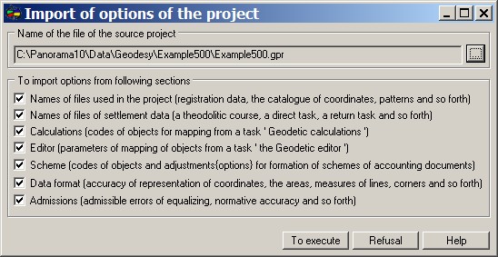
The given dialogue is used for carrying over options from one project into another. The execution of operation begins from the indication of a file name of the project from which it is necessary to execute import, to set sections for importation and to press "To execute" button. The program allows to operate import in conformity with pages of dialogue «Parameters of the project for a geodesy and land-surveying documentation». At import it is necessary to consider a number of restrictions. Classifiers of the maps of the current and imported projects should coincide. In case of discrepancy of classifiers there can be an incorrect setting up of codes of objects. Files of tables «Registration data» and «Catalogue of coordinates» should exist. At their absence the program will put an empty line.
|