Controlling a conventional symbol of object on a map |


|
|
The external view of an object on the map is determined by the conventional symbol assigned to this object. Symbols are contained in the digital classifier of the vector map. Assigning a conventional symbol for visualizing a database object on a map is possible in the following ways: - assigning a common conventional symbol for a data set (database table); - assignment of a personal conventional symbol for each record from the data set (database table) using a special field in the database table containing the classification code of the cartographic object.
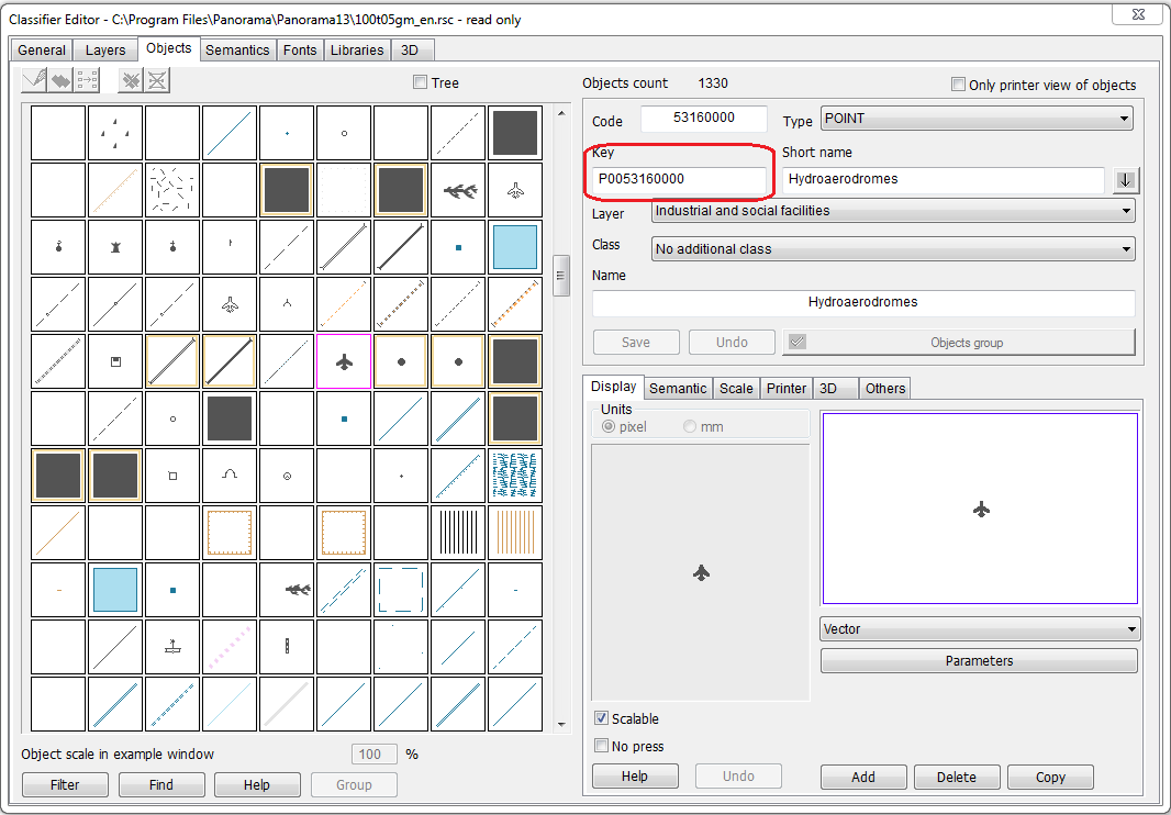
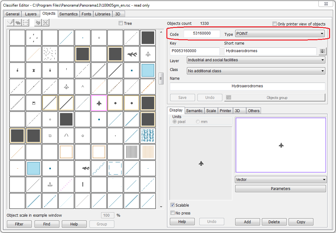
Identification of a conventional symbol is carried out by its key in the map classifier, or by the link «object code + type». Type is a type of spatial object: areal, linear, point. The key specifies an unambiguous definition of a conventional symbol - a specific object with a predetermined type. The object code can be repeated for objects with different type: for example, under one classification code there can be both areal rivers and linear ones. Besides, under one code there can be a whole series of objects.
Identification of conventional symbols by a key:
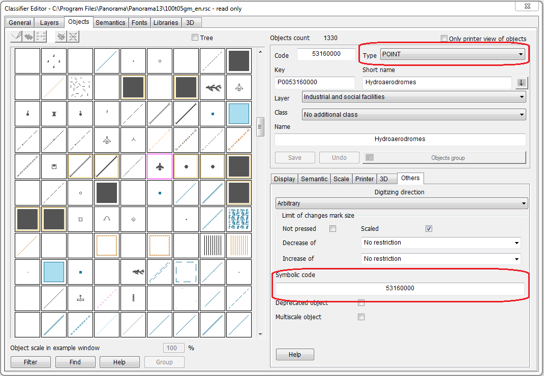
The conventional symbol is assigned by specifying the key of the map classifier object for the dataset, or the classification code of the map classifier object. When defining a conventional symbol by code, the type of the object (areal, linear, point or signature) signifies. Type is determined automatically by the spatial description of the object. An alphanumeric code can also be used as the classification code. The alphanumeric code is the analog of the numeric code and is also used jointly with the type of the object. In this case, objects of the «title» type can have a spatial description corresponding to the type of a line or point object. Therefore, for objects of the «title» type, an additional determining factor is the field assigned in the settings with the value of the title text and the fulfillment of the condition for the presence of a value in this field. A classification key or a code can be assigned to the entire dataset as a whole, or for each record separately. The second is achieved by having a separate field in the dataset containing a classification code or a key. What exactly will be used - a code or a key - is determined by the settings.
Identification of conventional symbols by classification code and type:
Identification of conventional symbols by alphanumeric classification code and type:
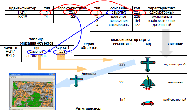
The external view of objects on the map can also be influenced by the value of the object semantics, which is filled from the attributive fields of the source database table. Possibility of automatic changing the external view of object on a map at changing the values of defined semantics is reached at the expense of using a series of objects. Series of objects is a grouping of conventional symbols inside the classifier of a vector map, which have the same localization (geometry type), but different by external view. In a series, one or two semantics are assigned, which are responsible for the selection of one or another conventional symbol from the series, and key (threshold) values of these semantics are defined. The values of these semantics must be numerical (or semantics-classifiers must be used). When the value of the semantics affecting the view passes through the specified threshold value, the object will be automatically displayed on the map by the symbol assigned to this value.
Automatic change of a conventional symbol when changing semantics:
Thus, in the program settings, you can specify one external view of objects for a set, but at the same time provide the possibility of different visualization of objects of this data set on the map. To do this, you need to specify a conventional symbol included into a series of objects, assign the correspondence of attributive fields to semantics that are responsible for the appearance of a series of objects, and customize the series of objects in the map classifier.
|