Recalculation of coordinates in text files |


|
|
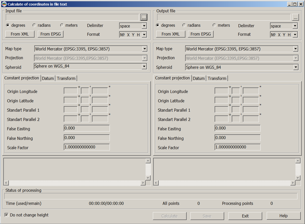
General view of the dialog:
As the initial data the text files with coordinates in an arbitrary coordinate system that can be downloaded from XLS tables, databases and other sources are used. Text files should have sets of coordinates in degrees, radians or the metres, broken into lines. Each line should contain coordinates of one point with delimiters.
Examples of a format of lines for different units of measure:
6147176.571 7415218.520 120.00 - unit of measure - meters; 0.53475614 2.59176266 120.00 - unit of measure - radians; 55.39938594 37.64461670 120.00 - unit of measure - degrees.
Format of a line for these examples is XYH, the delimiter is a space. Coordinate H (height) may be absent. When the option "Do not change height" is enabled, the value of H is not recalculated.
To perform a recalculation of coordinates it is necessary to choose a text file with coordinates, a separator character, indicate the initial coordinate system (map type, projection, spheroid, datum and constant projections) in which coordinates are written down. Then select the name of the output file, the coordinate system in which the recalculation result and the unit of measurement are needed. The choice of the coordinate system can be performed manually, by the EPSG code, or by the parameters from the XML file (LCS of the Subjects of the Russian Federation.xml).
The transformation of coordinates from the input user projection to the output projection is performed through geodetic coordinates on the common earth ellipsoid WGS84.
When you click the Calculate button, the calculation results are displayed in the window. The Save button is intended for writing into the output text file. |