Transform raster map |


|
|
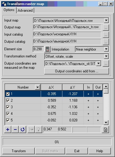
To determine the parameters of transformation it is necessary: - select a transformable raster from the list of open rasters; - specify a name of output raster; - specify the element size of an output raster. If the button - choose type of interpolation; - select the transformation method ;(see) - specify catalogs of coordinates of control points in the input and output coordinate system or to measure the points on the input and additional map (the map for the measurement of points in the output coordinate system). Points in the output coordinate system can be downloaded from the border of sheet, kilometer grid (code 13210000, 13220000) or the selected objects by clicking the "Output coordinates add from ..."; - if necessary to install advanced options. Recalculation of parameters of transformation is carried out automatically at measurement of points or at change of transformation parameters. By results of calculation of parameters of transformation the residual differences and a mean-square error are displayed. After calculation of transformation parameters it is possible to execute at once transformation, having pressed button "Transform", or for the analysis of nonlinear distortions to build matrixes of distortions by pressing the button «Build matrix». By results of transformation the protocol with prt extension in a folder of the transformed map is created. |