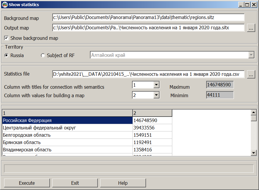
Show statistics |


|
|
The mode builds a thematic map based on statistical data of the subjects of the Russian Federation. Statistical data should be presented in the form of a table in CSV format. The table can consist of two or more columns, one of which must contain the names of the subjects of the Russian Federation. Construction of a thematic map is performed against the background of the RF map included into the installation (the map is specified in the regionstat.ini file). The map contains objects of the administrative division of the Russian Federation: the territories of federal districts, subjects and regions. Link of table fields with map objects is performed according to the "Name" semantics. For a better result, the table must contain the correct names of subjects. The regionstat.ini file is located in the c:\Users\Public\Documents\Panorama\Thematic\ folder and can be edited. The regionstat.ini file contains the key of processed objects, for example: 480-000-S (Territory of administrative units of the 1st order) and 482-000-S (Administrative region), as well as the path to the file "ГСК Субъектов РФ.xml". View of the "Show statistics" dialog:
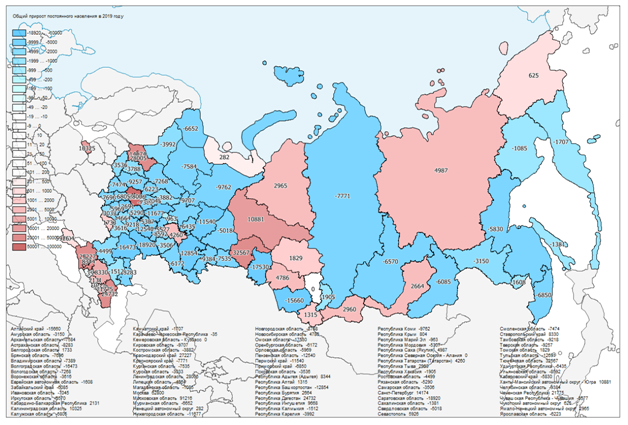
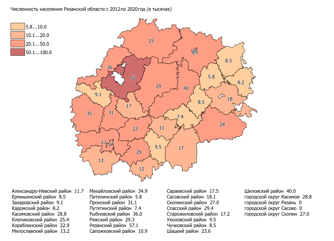
Statistics files *.csv or *.txt. are specified when calling the mode. You can change the file using the button "…". The text file must have the name of the region, numeric values for construction, a separator between the columns (Tab, ";", ","), ANSI or UTF-8 encoding. After opening the file, statistical analysis is performed, as a result of which the values of the range limits are automatically calculated. The type of the scale depends on the range of statistical data values. With a small spread of values (with a difference between the maximum and minimum values of less than 1000 conventional units), a scale with regular ranges is formed. With a larger spread of values - a logarithmic scale. The thematic map is built all over Russia or for the specified subject of the Russian Federation. When building by subject, a map is created for the specified region using the parameters from the file "ГСК Субъектов РФ.xml". The created map for the subject of the Russian Federation opens as a background one. Into program installation several examples have been added which are loaded from the website of the Federal State Statistics Servic Rosstat. Result of construction is the thematic map containing the colored territories of subjects of the Russian Federation or administrative districts, a scale of ranges of values of statistical data and the list of subjects of the Russian Federation with values of the selected statistical data.
The resulting map can be printed, or be saved into files of vector (SVG, EMF) and raster (PNG, TIFF) formats.
|