Measurement of points |


|
|
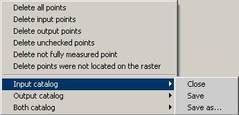
Measurement of points can be carried out in one-window or two-window modes. The one-window mode is convenient for use, when the transformed map can be displayed simultaneously with an additional map (a raster, a geoportal, a matrix) on which points are measured in output coordinate system. This is possible if the input and output coordinate system are either identical, or maps are geo-bound, i.e. in the map passport the parameters of projection, spheroid and Datum are correctly specified. This mode is intended for elimination of minor displacement on a map concerning its true position. In the two-window mode it is convenient to measure points if the input or additional map are not geo-bound, i.e. one of coordinate system is not defined. In this case the embedded into the GIS Panorama 11 the possibility of simultaneous displaying the maps in different coordinate systems is unavailable. The binding of windows to each other is carried out automatically by results of points measurement that allows to synchronize move by the maps in different windows. In the two-window mode the main window there is considered that window, which was active at the moment of starting the task. All vector maps opened in the main window are included into the list of input maps available for transformation. All maps opened in all windows are included into the list of additional maps. Additional maps can be added during the task performance, having pressed the button Transition between one-window and two-window mode is carried out automatically at a choice of an additional map. If the additional map is opened in one window with the input map, the window with these maps opens on full screen. If the additional map is opened in other window, the window with the input map is placed on the left, and a window with additional map to the right. In the GIS Panorama 11 is allowed joint displaying of maps in different coordinate systems. Therefore catalogues of coordinates are saved and loaded in the current coordinate system of the input and output map. Output coordinate system is defined by coordinate system of a current additional map. In a two-window mode the measurement of points is carried out by pressing the left button of the mouse on the main and additional map in the any order. In one-window mode at first it is necessary to measure a point in initial system of coordinates (there, where it is present now), then in output (there, where it should be). The measured point is shown on maps by circles with number of a point and in the table of the measured points. In an one-window mode the one-name points are connected by a line. Color of displaying a point on a map may be changed on the bookmark «Advanced». To select a point it is possible having chosen a point in the table by number, or to put the cursor at the necessary point, and to press a spacebar. The marked point will move to the center of a window. After measurement of one point an automatic synchronization of maps is carried out, i.e. at moving on one window the map in other window is displaced. You can disable synchronization on the bookmark «Advanced». Saving the measured points into catalogs of coordinates is done automatically when you close the task (if the mode is enabled «Automatically save catalogs of coordinates while exit») or when you click the button
The points that are downloaded from the catalogs of coordinates may be measured in addition or remeasured on the map. If one catalogue of coordinates is downloaded only, to measure points in another coordinate system it is possible by using of the «Remeasure» with the enabled mode for the convenience «The transition to the next point after a remeasurement». At each measurement the parameters of transformation automatically are recalculated. If parameters of transformation were not calculated, residual divergences and a mean-square deviation will not be displayed. You can learn the reason of error when you click "Transform" button. Thus the message describing the error will be given. More often the reason of an error is the insufficient number of the measured points for the chosen type of transformation. After definition of parameters of transformation there are calculated the divergences on points before and after modelling by the chosen type of transformation. Divergences on points after application of modelling are shown in the table which can be sorted by value of a divergence, having pressed the header of the appropriate column of the table. Divergences before application of modelling can be seen in the report by pressing the button By residual divergences there are calculated the mean-square deviations (MSD) characterising accuracy of a map before and after transformation. The calculated mean-square deviations are shown below the table by groups of three numbers. On the top there are shown MSD before application of modelling, below - MSD after application of modelling. Below at the left MSD is shown on the basic (enabled) points, below on the right - MSD on the control (disabled) points. In each group the first number is the MSD on the axes X, the second MSD on Y, the third - MSD in the plan. At placing the mouse on each of numbers there is shown a hint with the field name and the number of points participating in calculation of MSD. For detailed analysis, you can view the protocol of computation of transformation parameters by pressing a button If many points are measured, slow-down of work of the program is possible at calculating parameters of transformation by type of linear, nonlinear rubber sheet. In this case, the points should be measured in the mode of an affine transformation, and after measuring all the points to change the type of transformation onto the rubber sheet. In the task three operating modes are accessible: 1. Measure 2. Remeasure In the one-window mode a remeasurement of the current point in the input coordinate system is made by pressing the left mouse button, and an output coupled with the key Ctrl. In two-window mode points are remeasured at pressing the left mouse button in the main or secondary window. 3. Delete The point is not obligatory for deleting from the list. To exclude it from the list of points used for calculating the elements of orientation you can having removed a tick in number of a point. At measurement and remeasurement the mode «Snap to point» If to include «The transition to the next point after a remeasurement» To refuse measurement of a point and to move to the next one you can click the «N». |