Build the well axis by coordinates |


|
|
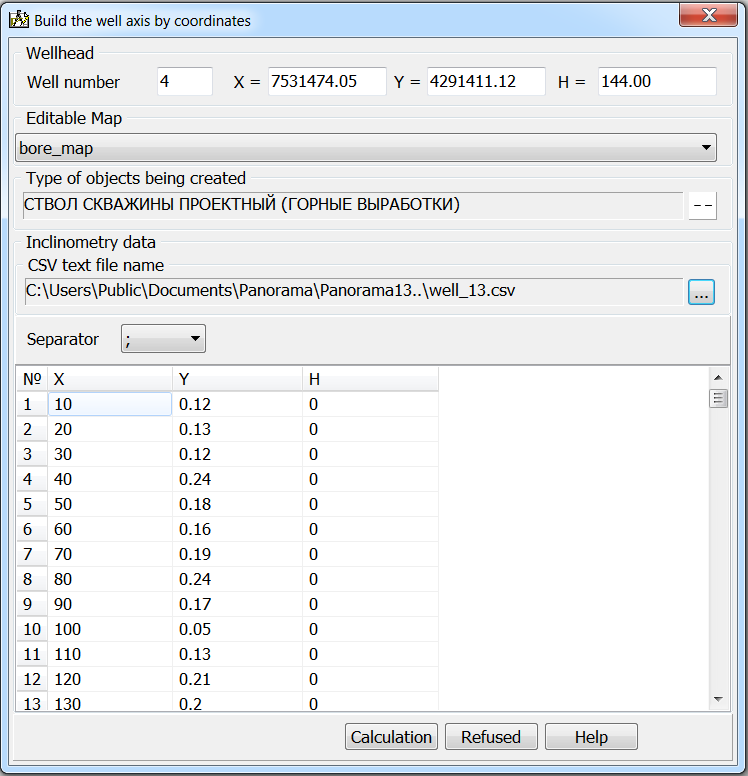
To call the dialog «Create wellbore axis (import from CSV)», it is necessary to press the mode button and to choose on a map a dot object - collar of well. Further in the dialog you must specify the name of the CSV file, select a map for drawing the results and the view of objects to be created. The result of processing one CSV file is a linear object - the projected wellbore axis.
|
 The mode is intended for mapping a linear object characterizing the spatial position of the wellbore axis. As the initial data the CSV file in XYH structure, containing coordinates of characteristic points of the wellbore axis is used.