Build the well axis by inclinometry |


|
|
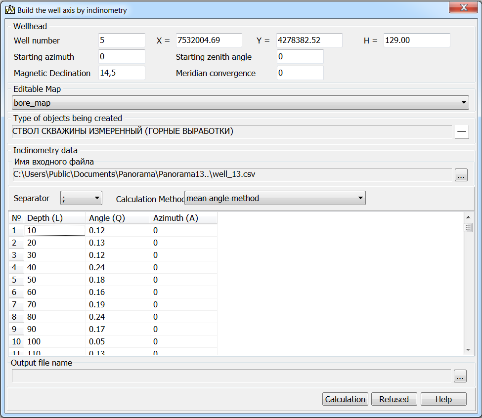
To call the dialog «Build the well axis by inclinometry», you must press the mode button and select a point object on the map - the wellhead. Then, in the dialog, specify the name of the inclinometry file, select the map for drawing the results, the type of objects to be created and the calculation method. The task supports three methods for calculating an inclinometry: the radius of curvature method, the mean angle method and the minimum curvature method. For the calculation, the coordinates of the wellhead (X0, Y0, H0) and measurements at the current point are used: L - depth, Q - zenith angle and A - magnetic azimuth. The coordinates of the well axis are calculated based on the measurements of the zenith angle and azimuth of the well, and also the depth of the wellbore at the measurement point. For the calculation, it is necessary additionally to indicate the initial drilling conditions: initial azimuth, initial zenith angle, magnetic declination and meridian convergence. The result of processing one source file is a linear object - the actual trajectory of the wellbore axis.
|
 The mode is intended for mapping a linear object characterizing the spatial position of the wellbore axis. As the initial data, a CSV file in the LQA structure is used, containing the measured values of inclinometry: L - the depth of the well at the current point, Q - zenith angle of the current point, A - the magnetic azimuth of the current point.