Build of intersection layers |


|
|
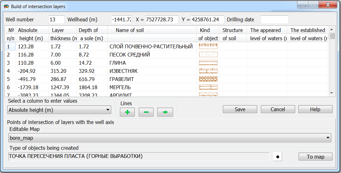
To call the dialog «Build of intersection layers», you must press the mode button and select a point object on the map - the wellhead. Next, in the dialog, select a map for drawing the results and the type of objects to be created. Based on the data on the depth of a sole of the geological layer, the spatial coordinates of the point of intersection with the well axis are calculated. You do not need to enter any additional information for the calculation. The result of processing one is point objects by the number of exposed geological layers.
|
 The mode is intended for mapping point objects describing the spatial position of the points of intersection of the wellbore axis and a sole of geological layers. As the initial data, there is used an information about opened geological layers, specified by means of the mode