Raster projection reforming |


|
|
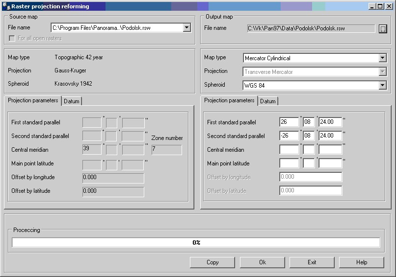
The task of converting a projection of a raster allows to change a type of raster projection, parameters of a projection, spheroid and a Datum. For example, it is possible to change zone number of of a map, type of a map, to go from system of coordinates of a topographical map of 95 year to a geographical map in Mercator projection on the spheroid WGS84 and so on. Dialog of the task consists of 2 parts. In the left part the source projection parameters of a raster are displayed. If parameters of a projection are not installed or entered uncompletely the task cannot be executed. In the right part the same projection parameters of a raster are initially displayed. It is possible to change separate values or to enter completely new values. By means of the Copy button it is possible to copy parameters of a projection from an existing map, a raster or a matrix.
The map in a new projection will be placed in a folder specified by the user in the Output map field. All names of files of a map remain without changes. If the open document contains several maps then the maps can be converted at once all. For this purpose it is necessary to choose the field For all open rasters. After a choice of the necessary values it is necessary to press Ok button. After finishing the converting the new map will be automatically open in a new window. |